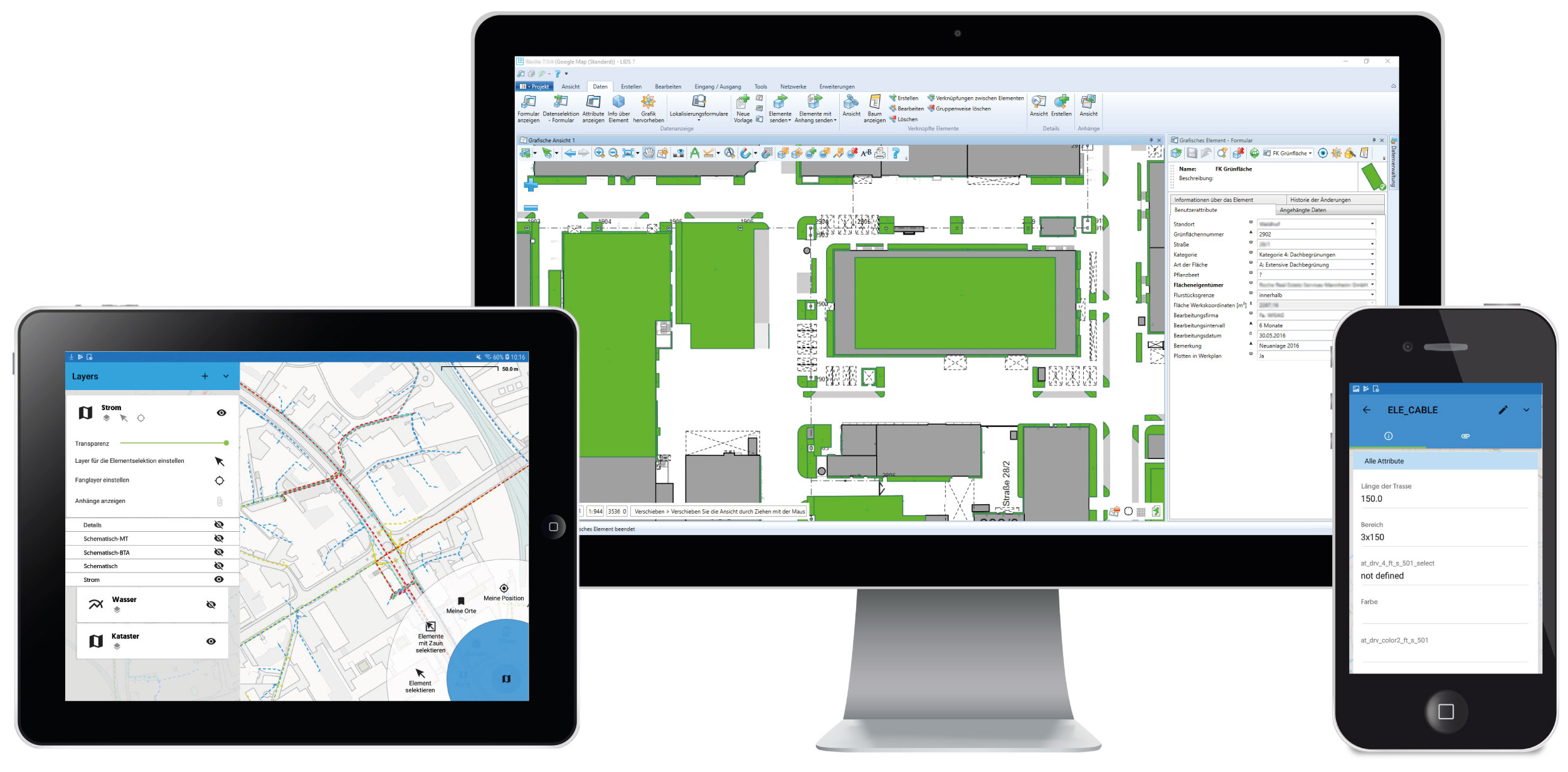
SAMO LIDS is an open geographic information system and asset register built on proven industrial standards and first-rate information technologies designed to capture, manage, analyse and display semantical and spatial oriented data.
SAMO LIDS is the foundation and central asset base to serve special solutions for companies managing extensive assets, public and private infrastructures, wide landscapes, large industrial areas, mines etc.
SAMO LIDS offers comfortable access to attributive and GIS data, simple creation of queries, high quality map outputs, topological task tracing and data publishing (e.g. Open Data, INSPIRE).
SAMO LIDS provides general 2D/3D GIS functionality as well as specialized solutions e.g. for routes and cross sections, in detail fibre management, linear referencing, CAD integration etc.
Improve your daily business
Main benefits

Efficient tools for data capturing and maintenance.

Proven yet flexible data models and industry solutions.

High-performance management of raster data (e.g. aerial photos).

Special solution for fibre network management.

Flexible CAD-integration and multiple import/export capabilities.

Synchronized offline data entry with conflict management.

Top thematized outputs, output reports, details, schemes, longitudinal profiles, etc.

Spatial and topological features.
Easy to use clients for mobile, web and desktop
Use SAMO LIDS on all your devices